Correction signals for CLAAS steering systems.

Even greater precision.

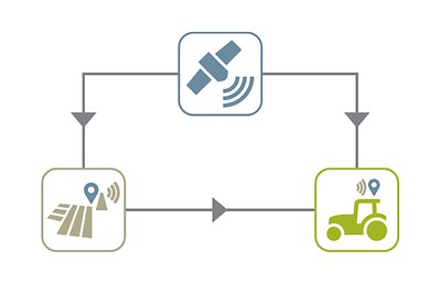
Correction signals make your CLAAS steering systems work even more effectively. The systems receive the GPS signal from the satellite and improve its accuracy.

Correction signals for CLAAS steering systems.

Even greater precision.

Correction signals make your CLAAS steering systems work even more effectively. The systems receive the GPS signal from the satellite and improve its accuracy.

Correction signals for CLAAS steering systems.


Correction signals

± 2-3 cm*

RTK

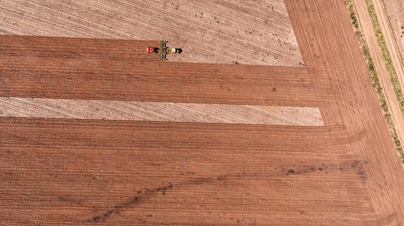
RTK is the ideal correction signal when every centimetre counts, e.g. for drilling, crop protection or harvesting applications. The accuracy of ± 2-3 cm is repeatable year after year. So you can be certain that field boundaries are always in the right place for using Section Control applications and that references lines are always in the same place, which is essential for using Strip Till or Controlled Traffic Farming. An initialisation time of less than one minute means you can get straight on with the job without delay. And with RTK Bridging as standard, you can carry on working even if the RTK signal drops out from time to time.


Correction signals

From any location

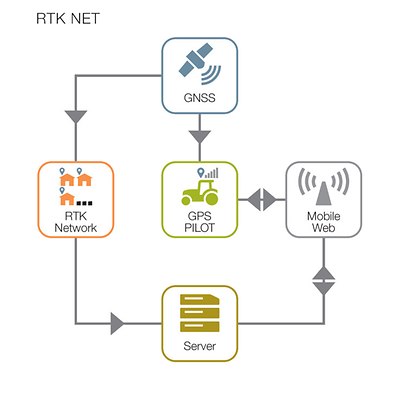
RTK NET

  • Transfer via mobile phone network

RTK NET works independently of any radius, making it the ideal solution for contractors and farms seeking to work with optimum precision without being constrained by distance.


Correction signals

30 km range, up to 50 km with loss of accuracy

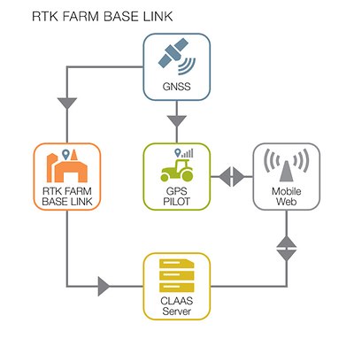
RTK FARM BASE LINK

  • Station data transmitted via the mobile phone network (NTRIP)

Do your fields lie within a 30 km radius? The RTK FARM BASE LINK can supply the correction signal from the RTK FARM BASE reference station (dealership's reference station) to the mobile phone network. With good mobile phone coverage, this can increase your operating radius around the station without loss of accuracy.


Correction signals

± 2-3 cm*

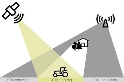
NEW: RTK Bridging/ RTK Bridging Premium

  • Satellite-based correction signal bridges the RTK signal in the event of signal loss
  • Available virtually worldwide
  • RTK Bridging is included with every RTK activation
  • RTK Bridging Premium requires a licence


Correction signals

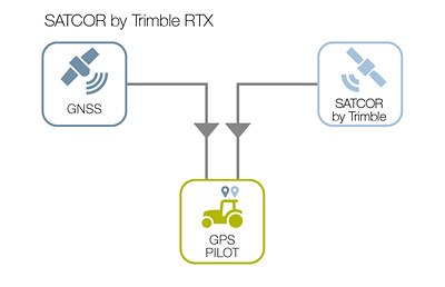
± 15 cm (SATCOR 15); ± 3 cm (SATCOR 3)*

NEW: SATCOR by Trimble RTX

  • Virtually worldwide coverage
  • Improved basic accuracy
  • Satellite-based correction signal from CLAAS
  • Subject to licence


Correction signals

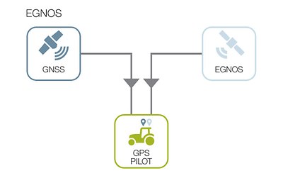
± 30 cm*

EGNOS

  • Basic accuracy
  • Single-frequency signal (EGNOS / WAAS)
  • No licence fee

  • *Disclaimers for correction signals.

    Please note that some variants are not available in every country. Please contact your distributor for further information.

    EGNOS is a service available free of charge in Europe. WAAS is a comparable service for North America. Please note that both systems may produce a shift in track lines over time (satellite drift). These systems are not suitable for use in machine fleets (e.g. combine harvesting), or drilling operations.

    The accuracy data given relates to the accuracy of the GPS receiver on the machine under perfect conditions. All data are expressed as maximum values. A distinction is made between pass-to-pass accuracy and absolute accuracy. Pass-to-pass accuracy defines the accuracy of the subsequent pass in 95% of cases within 15 min of the reference track. Absolute accuracy defines at what level of accuracy a certain position can be found at a later time. The actual accuracy of the overall system can deviate from the abovementioned accuracy data. It depends on various factors such as vehicle (wheelbase, ballasting, calibration, etc.), attached implements (drift, configuration, attached front implements, etc.), and field and soil conditions.

    The pricing of the individual services depends upon the region and the provider.

    In the case of correction data services transmitted via mobile phone networks, availability is dependent on the coverage of the network provider used.

    CLAAS assumes no liability for circumstances or events beyond its control. These may include, for example, disturbances in the atmosphere/troposphere/ionosphere, breakdowns/disruptions to and/or insufficient availability and shutdowns of satellites within global navigation satellite systems (GPS, GLONASS, GALILEO und BEIDOU) and their ground reference stations or of satellites belonging to correction service providers (EGNOS, SATCOR by Trimble RTX, etc.).